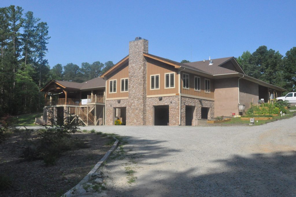
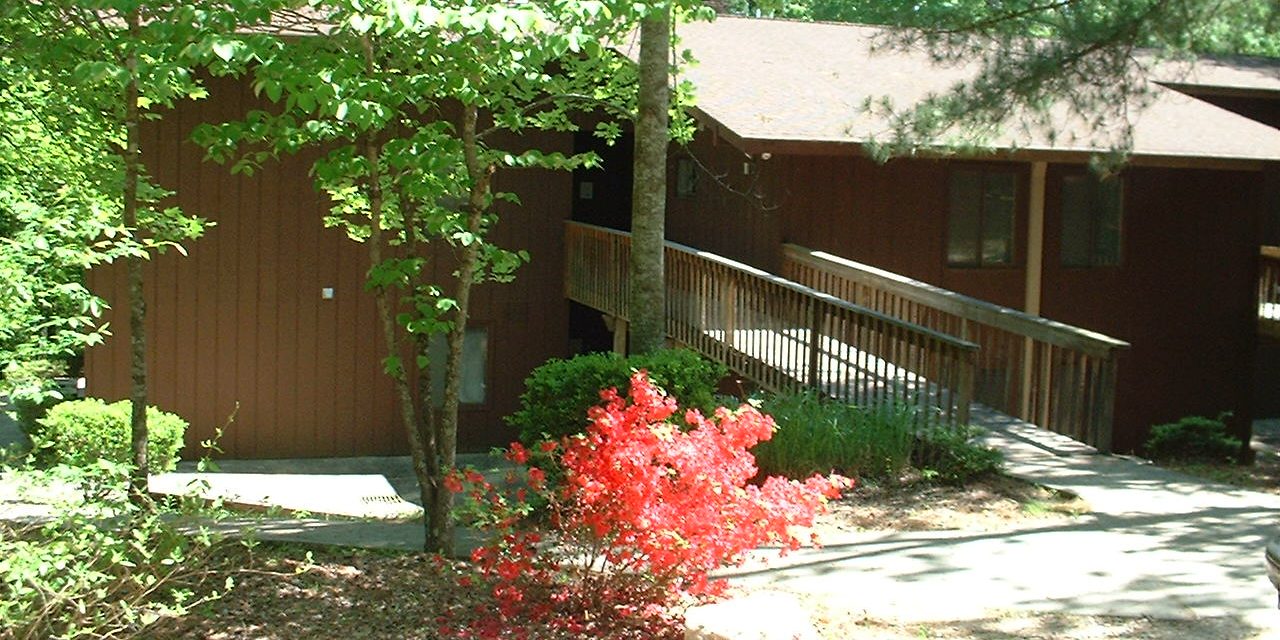
Facilities
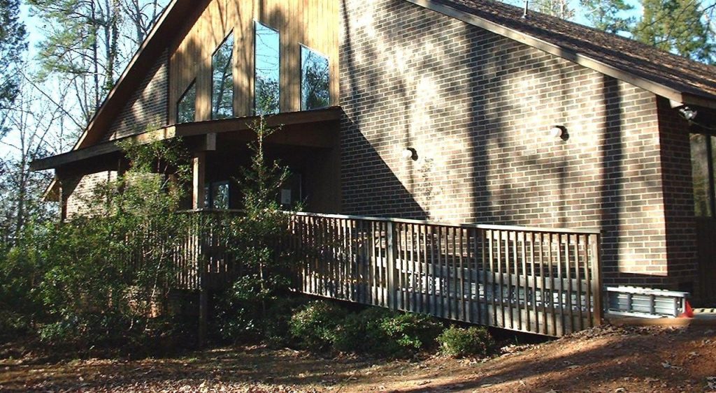
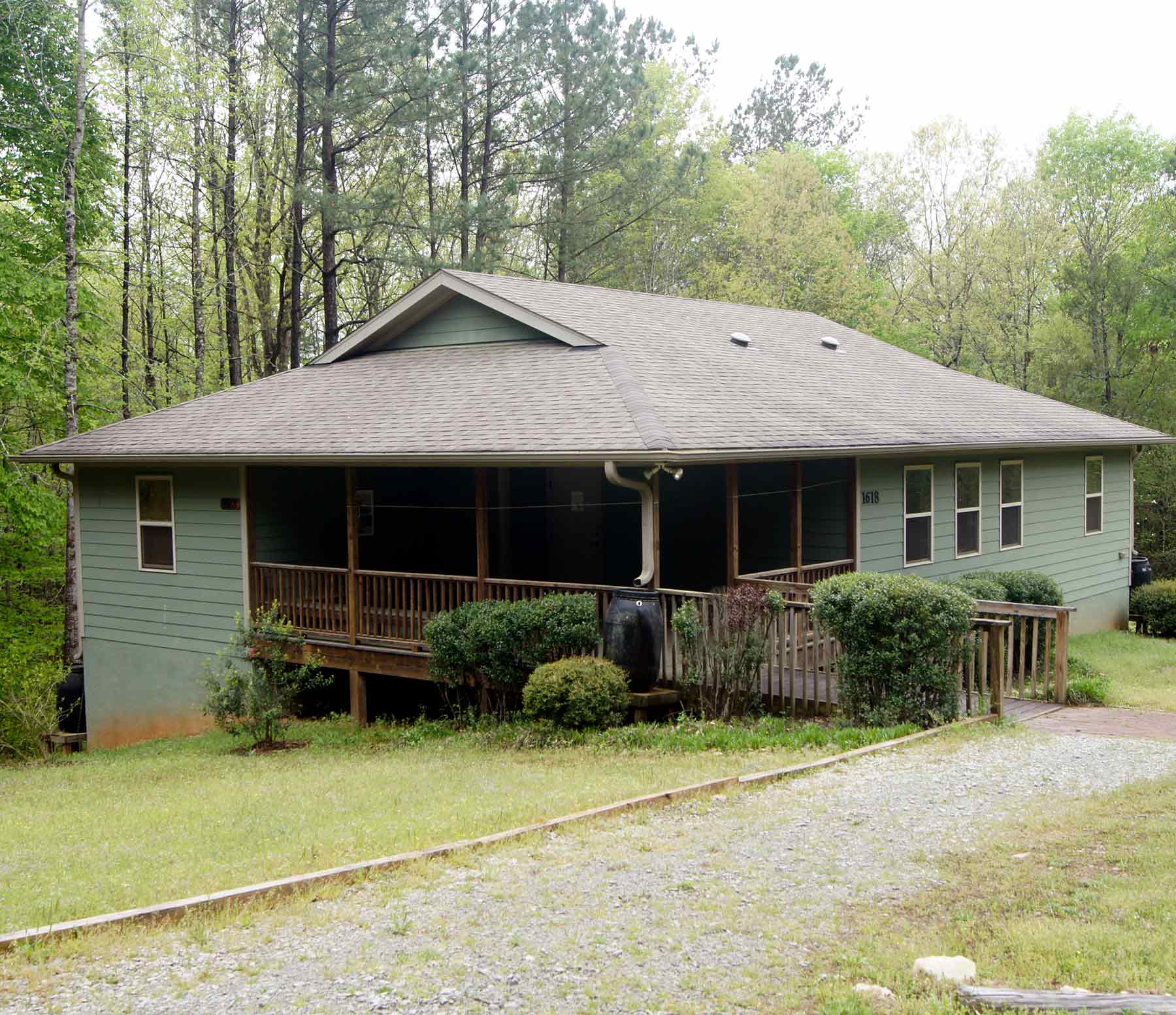
Located on 624 acres of beautiful rolling hills, cascading streams, and diverse forests, Camp Agapé is located just 50 minutes from downtown Raleigh.
Driving Directions
Please contact us if you have any questions about traveling to Camp Agapé.
DIRECTIONS TO CAMP AGAPÉ
FROM EASTERN SIDE OF RALEIGH AND POINTS NORTH:
(Directions from Western side of Raleigh using Rex Rd or Hwy 55 bypass have their own pages)
In general, any directions have potential to be confusing for many people, especially to a place well secluded from the bustle of traffic and city roads. In order for directions to be effective, you must trust in them and not second-guess what is written. If you follow our written directions exactly (especially where exact distances are underlined), you should arrive without getting lost along the way.
From East side of Raleigh, take Exit 298 off I-40 onto South Saunders St. (Hwy 401).
Stick to the right hand lanes to stay on Hwy 401 toward Fuquay-Varina.
Take 401S to Fuquay-Varina.
Stay on 401 through most of Fuquay-Varina
Hwy 42 West joins 401 early in Fuquay.
When passing Ruby Tuesday, stay in the left lane. The next traffic light is at Hwy 55
Continue STRAIGHT through the traffic light at Hwy 55 (stay on 42/401).
Go straight through one more traffic light.
Proceed to the next traffic light, which is where Hwy 42 and Hwy 401 split.
Turn RIGHT at this traffic light (Academy Street) to stay on Hwy 42 West.
Drive 4.7 miles to Cokesbury Road.
At around 4 miles into this stretch there is a Marathon Station called “Duncan Junction”.
After Duncan Junction, cross the railroad tracks—the next road on the left is Cokesbury Road.
Turn LEFT onto Cokesbury Road. (The same road is named Buckhorn Duncan to the right)
Drive 3.7 miles to River Road.
Landmark—Radio tower on the left at River Road.
Turn RIGHT onto River Road.
Drive 1.7 miles to the Agapé driveway.
Landmark: Cokesbury United Methodist Church on left soon after turning onto River Road.
Landmark: Chalk Level Church on left just before the Agapé driveway.
The Agapé Driveway is on the right marked with a large white sign.
Turn RIGHT onto the Agapé Driveway. (Tyler Dewar Lane)
Drive 0.9 mile to the well-marked main entrance. (beginning of gravel road)
WELCOME! Follow the signs to where you need to be.
If you are the group leader or are arriving earlier than your group leader, please stop at the Office Welcome Center ahead and left as you enter camp.
DIRECTIONS TO CAMP AGAPÉ
FROM WESTERN SIDE OF RALEIGH (Rex Road version):
(Directions from Eastern side of Raleigh and Raleigh using Hwy 55 bypass have their own pages)
In general, any directions have potential to be confusing for many people, especially to a place well secluded from the bustle of traffic and city roads. In order for directions to be effective, you must trust in them and not second-guess what is written. If you follow our written directions exactly (especially where exact distances are underlined), you should arrive without getting lost along the way.
Follow the Beltline (I-440); get onto Hwy 1 South.
Follow Hwy 1 PAST the Hwy 55 exit.
Travel about another 6 miles past the Hwy 55 exit to exit #89 (New Hill / Jordan Lake exit).
Turn LEFT at the top of the exit #89 ramp onto New Hill Road.
Landmarks: Soon after turning onto New Hill Road, there is a recycling center on your left.
Shearon Harris power plant is on the right along this road.
Harris Lake County Park is on the right along this road.
After crossing part of Harris Lake, you soon come to a stop sign.
Continue STRAIGHT through stop sign onto Rex Road (same road, different name).
At the next stop sign, Turn RIGHT onto Cass Holt Road and travel ONLY 0.1 mile.
(There will be a red and white brick convenience store on the left—“Friendly’s Grocery”.)
Turn LEFT onto Buckhorn Duncan Road at Friendly’s Grocery.
Drive 3.3 miles, coming to a stop sign just past a water tower over the Harnett County line.
This stop sign is at the Hwy 42 intersection.
(At the intersection’s stop sign, there is a small brick building on your left, and Duncan Baptist
church is a short way up the road to your right.)
Cross STRAIGHT across Hwy 42, and Buckhorn Duncan changes names to Cokesbury Rd.
Drive 3.7 miles on Cokesbury Road to River Road.
Landmark: radio tower on left at River Road intersection.
Turn RIGHT onto River Road.
Travel 1.7 miles to the Agapé driveway.
Landmark: Cokesbury United Methodist Church on left soon after turning onto River Road.
Landmark: Chalk Level Church on left just before the Agapé driveway.
The Agapé Driveway is on the right marked with a large white sign.
Turn RIGHT onto the Agapé Driveway. (Tyler Dewar Lane)
Drive 0.9 mile to the well-marked main entrance. (beginning of gravel road)
WELCOME! Follow the signs to where you need to be.
If you are the group leader or are arriving earlier than your group leader, please stop at the Office Welcome Center ahead and left as you enter camp
DIRECTIONS TO CAMP AGAPÉ
FROM WESTERN SIDE OF RALEIGH (Hwy 55 version):
(Directions from Eastern side of Raleigh and Raleigh using Rex Road have their own pages)
In general, any directions have potential to be confusing for many people, especially to a place well secluded from the bustle of traffic and city roads. In order for directions to be effective, you must trust in them and not second-guess what is written. If you follow our written directions exactly (especially where exact distances are underlined), you should arrive without getting lost along the way.
Follow the Beltline (I-440); get onto Hwy 1 South.
Take the Hwy 55 exit (Fuquay-Varina exit).
Turn LEFT at the top of the exit ramp onto Hwy 55 East (traveling south).
Travel STRAIGHT through several traffic lights and continue on Hwy 55 bypass. Avent Ferry Rd. is your next turn.
Turn RIGHT at traffic light onto Avent Ferry Rd. Drive 0.2 miles to next traffic light. (Piney Grove Wilbon Rd)
Turn LEFT onto Piney Grove Wilbon Rd.
Drive 4.8 miles on Piney Grove Wilbon to a traffic light (Hwy 42)
Turn RIGHT on Hwy 42 West (Academy Street).
Drive 1.8 miles on Hwy 42 to Cokesbury Road
Landmark: Marathon station (Duncan junction) on your left
Landmark: Railroad tracks just before the intersection of 42 & Cokesbury
Turn LEFT onto Cokesbury Road (Cokesbury Rd. is named “Buckhorn Duncan” to the right).
Drive 3.7 miles on Cokesbury Road to River Road.
Landmark: radio tower on left at River Road intersection.
Turn RIGHT onto River Road.
Travel 1.7 miles to the Agapé driveway.
Landmark: Cokesbury United Methodist Church on left soon after turning onto River Road. Landmark: Chalk Level Church on left just before the Agapé driveway.
The Agapé Driveway is on the right marked with a large white sign.
Turn RIGHT onto the Agapé Driveway. (Tyler Dewar Lane)
Drive 0.9 mile to the well-marked main entrance. (beginning of gravel road)
WELCOME! Follow the signs to where you need to be.
If you are the group leader or are arriving earlier than your group leader, please stop at the Office Welcome Center ahead and left as you enter camp.
DIRECTIONS TO CAMP AGAPÉ
FROM DURHAM & POINTS WEST USING I-40 EAST:
(Traveling on Hwy 64 East when appropriate can help you avoid heavy interstate traffic)
(Directions for using Hwy 64 East are on a separate page)
In general, any directions have potential to be confusing for many people, especially to a place well secluded from the bustle of traffic and city roads. In order for directions to be effective, you must trust in them and not second-guess what is written. If you follow our written directions exactly (especially where exact distances are underlined), you should arrive without getting lost along the way.
From I-40, take exit #274. Travel SOUTH on Hwy 751 until it intersects Hwy 64 at a traffic light.
Hwy 751 “ends” at Hwy 64, but the road continues, changing names to New Hill Road on the other side of Hwy 64.
Take New Hill Road (South).
Follow New Hill Road, crossing over Hwy 1 and passing Shearon Harris power plant. After crossing part of Harris Lake, you soon come to a stop sign.
Continue STRAIGHT through stop sign onto Rex Road (same road, different name).
At the next stop sign, Turn RIGHT onto Cass Holt Road and travel ONLY 0.1 mile. (There will be a red and white brick convenience store on the left—“Friendly’s Grocery”.)
Turn LEFT onto Buckhorn Duncan Road at Friendly’s Grocery.
Drive 3.3 miles, coming to a stop sign just past a water tower over the Harnett County line. This stop sign is at the Hwy 42 intersection. (At the intersection’s stop sign, there is a small brick building on your left, and Duncan Baptist church is a short way up the road to your right.)
Cross STRAIGHT across Hwy 42, and Buckhorn Duncan changes names to Cokesbury Rd.
Drive 3.7 miles on Cokesbury Road to River Road.
Landmark: radio tower on left at River Road intersection.
Turn RIGHT onto River Road.
Travel 1.7 miles to the Agapé driveway.
Landmark: Cokesbury United Methodist Church on left soon after turning onto River Road.
Landmark: Chalk Level Church on left just before the Agapé driveway.
The Agapé Driveway is on the right marked with a large white sign.
Turn RIGHT onto the Agapé Driveway. (Tyler Dewar Lane)
Drive 0.9 mile to the well-marked main entrance. (beginning of gravel road)
WELCOME! Follow the signs to where you need to be.
If you are the group leader or are arriving earlier than your group leader, please stop at the Office Welcome Center ahead and left as you enter camp.
DIRECTIONS TO CAMP AGAPÉ
FROM POINTS WEST OF DURHAM USING HWY 64 EAST
AVOIDING I-40 CONGESTION: (directions using I-40 have their own page)
In general, any directions have potential to be confusing for many people, especially to a place well secluded from the bustle of traffic and city roads. In order for directions to be effective, you must trust in them and not second-guess what is written. If you follow our written directions exactly (especially where exact distances are underlined), you should arrive without getting lost along the way.
From Charlotte, Kannapolis, and Salisbury areas, I-85 and Hwy 64 connect near Lexington.
From Statesville, Hickory, and points West, I-40 connects with Hwy 64 (Exit # 168).
From Winston-Salem and Greensboro areas, Hwy 421 brings you to Hwy 64.
From the Burlington area, Hwy 87 brings you to Hwy 64.
From Chapel Hill and Durham areas, Hwy 751 brings you directly to New Hill Road on Hwy 64
(the third bold section in the directions below—go straight at the Hwy 64/Hwy 751 traffic light
to get onto New Hill Rd and continue from “Follow New Hill Road, crossing over…”).
Travel on Hwy 64 East to the Pittsboro area.
PASS the Hwy 15/501 Exit.
Drive 13.5 miles past the exit to a traffic light intersection:
This intersection is where Hwy 751 begins, traveling north—you will travel south here.
RIGHT onto New Hill Road (South).
Follow New Hill Road, crossing over Hwy 1 and passing the Shearon Harris power plant. After crossing part of Harris Lake, you soon come to a stop sign.
Continue STRAIGHT through stop sign onto Rex Road (same road, different name).
At the next stop sign, Turn RIGHT onto Cass Holt Road and travel ONLY 0.1 mile.
(There will be a red and white brick convenience store on the left—“Friendly’s Grocery”.)
Turn LEFT onto Buckhorn Duncan Road at Friendly’s Grocery.
Drive 3.3 miles, coming to a stop sign just past a water tower over the Harnett County line.
This stop sign is at the Hwy 42 intersection.
(At the intersection’s stop sign, there is a small brick building on your left, and Duncan Baptist
church is a short way up the road to your right.)
Cross STRAIGHT across Hwy 42, and Buckhorn Duncan changes names to Cokesbury Rd.
Drive 3.7 miles on Cokesbury Road to River Road.
Landmark: radio tower on left at River Road intersection.
Turn RIGHT onto River Road.
Travel 1.7 miles to the Agapé driveway.
Landmark: Cokesbury United Methodist Church on left soon after turning onto River Road.
Landmark: Chalk Level Church on left just before the Agapé driveway.
The Agapé Driveway is on the right marked with a large white sign.
Turn RIGHT onto the Agapé Driveway. (Tyler Dewar Lane)
Drive 0.9 mile to the well-marked main entrance. (beginning of gravel road)
WELCOME! Follow the signs to where you need to be.
If you are the group leader or are arriving earlier than your group leader, please stop at the Office Welcome Center ahead and left as you enter camp.
DIRECTIONS TO CAMP AGAPÉ
FROM SANFORD AND POINTS WEST:
(Sanford and areas near I-74 corridor between Monroe and Laurinburg)
In general, any directions have potential to be confusing for many people, especially to a place well secluded from the bustle of traffic and city roads. In order for directions to be effective, you must trust in them and not second-guess what is written. If you follow our written directions exactly (especially where exact distances are underlined), you should arrive without getting lost along the way.
General directions:
The I-74 corridor runs east to Hwy 1, and Hwy 1 runs north to Sanford. Follow specific directions below from Sanford.
Follow Route 42 East from Sanford, through Corinth, continue on Hwy 42 East toward Fuquay.
Once crossing the Harnett County line, it is 1.6 miles to Ball Road.
Landmarks: East Mill Lane is on left 0.2 mile before Ball Road. Ball Road is around a curve.There is a small reflective “Agapé” sign on the left, across from Ball Road.
Turn RIGHT on Ball Road. Follow Ball Road to the end (about 2 miles).
Turn RIGHT onto Cokesbury Road.
Drive 0.5 mile to River Road (River Road is also named “Oakridge River Road” to the left).
Landmark: radio tower on far left at intersection of River Road and Cokesbury.
Turn RIGHT onto River Road.
Travel 1.7 miles to the Agapé driveway.
Landmark: Cokesbury United Methodist Church on left soon after turning onto River Road.
Landmark: Chalk Level Church on left just before the Agapé driveway.
The Agapé Driveway is on the right marked with a large white sign.
Turn RIGHT onto the Agapé Driveway. (Tyler Dewar Lane)
Drive 0.9 mile to the well-marked main entrance. (beginning of gravel road)
WELCOME! Follow the signs to where you need to be.
If you are the group leader or are arriving earlier than your group leader, please stop at the Office Welcome Center ahead and left as you enter camp.
DIRECTIONS TO CAMP AGAPÉ
FROM DUNN, FAYETTEVILLE, LILLINGTON AND POINTS SOUTH & SOUTH EAST:
In general, any directions have potential to be confusing for many people, especially to a place well secluded from the bustle of traffic and city roads. In order for directions to be effective, you must trust in them and not second-guess what is written. If you follow our written directions exactly (especially where exact distances are underlined), you should arrive without getting lost along the way.
DUNN: Take Hwy 421 past Campbell University and go straight onto 401 N near Lillington.
FAYETTEVILLE: Take 401 N through Lillington.
LILLINGTON: Take 401 N
From the Junction Of 421/401 near Lillington…
Landmark: McDonalds is at this intersection.
Drive 3.3 Miles on 401N to Christian Light Road.
Landmark: The “Donnibrook” subdivision is on the right, marked by a large sign. Just over the crest of the hill that the Donnibrook sign is on, Christian Light Road begins on the left.
Turn LEFT onto Christian Light Road.
Small sign also says “Corinth” & “Cokesbury”
Travel about 4 miles to Cokesbury Road.
Note: DO NOT TAKE RIVER ROAD OFF OF CHRISTIAN LIGHT ROAD.
Landmarks at Cokesbury Road corner:
CITGO station (“Bob & Nan’s”) on right, Christian Light Christian Church on left.
Turn LEFT onto Cokesbury Road.
Drive about 3 miles to River Road
Landmarks on the way to River Road:
Union Baptist Church on left. River Road is 0.8 miles past this church.
Watch for a long white fence on the left just before the River Road corner.
Radio tower on the right at River Road corner.
Turn LEFT onto River Road.
Travel 1.7 miles to the Agapé driveway.
Landmark: Cokesbury United Methodist Church on left soon after turning onto River Road.
Landmark: Chalk Level Church on left just before the Agapé driveway.
The Agapé Driveway is on the right marked with a large white sign.
Turn RIGHT onto the Agapé Driveway. (Tyler Dewar Lane)
Drive 0.9 mile to the well-marked main entrance. (beginning of gravel road)
WELCOME! Follow the signs to where you need to be.
If you are the group leader or are arriving earlier than your group leader, please stop at the Office Welcome Center ahead and left as you enter camp.
DIRECTIONS TO CAMP AGAPÉ
FROM THE EAST OR SOUTH USING I-40W:
(ONLY if you are confident following country roads off of I-40, there is a slightly shorter route entitled “SHORTCUT DIRECTIONS TO CAMP AGAPÉ FROM POINTS EAST OR SOUTH USING I-40 WEST”)
In general, any directions have potential to be confusing for many people, especially to a place well secluded from the bustle of traffic and city roads. In order for directions to be effective, you must trust in them and not second-guess what is written. If you follow our written directions exactly (especially where exact distances are underlined), you should arrive without getting lost along the way.
Take I-40W to Exit #312 – Hwy 42.
Take Hwy 42 West into and through Fuquay-Varina.
Hwy 42 West joins 401 early in Fuquay.
When passing Ruby Tuesday, stay in the left lane. The next traffic light is at Hwy 55.
Continue STRAIGHT through the traffic light at Hwy 55 (stay on 42/401).
Go straight through one more traffic light.
Proceed to the next traffic light, which is where Hwy 42 and Hwy 401 split.
Turn RIGHT at this traffic light (Academy Street) to stay on Hwy 42 West.
Drive 4.7 miles to Cokesbury Road.
At around 4 miles into this stretch there is a Marathon Station called “Duncan Junction”.
After Duncan Junction, cross the railroad tracks—the next road on the left is Cokesbury Road.
Turn LEFT onto Cokesbury Road. (The same road is named Buckhorn Duncan to the right)
Drive 3.7 miles to River Road.
Landmark—Radio tower on the left at River Road.
Turn RIGHT onto River Road.
Drive 1.7 miles to the Agapé driveway.
Landmark: Cokesbury United Methodist Church on left soon after turning onto River Road.
Landmark: Chalk Level Church on left just before the Agapé driveway.
The Agapé Driveway is on the right marked with a large white sign.
Turn RIGHT onto the Agapé Driveway. (Tyler Dewar Lane)
Drive 0.9 mile to the well-marked main entrance. (beginning of gravel road)
WELCOME! Follow the signs to where you need to be.
If you are the group leader or are arriving earlier than your group leader, please stop at the Office Welcome Center ahead and left as you enter camp.
SHORTCUT DIRECTIONS TO CAMP AGAPÉ
FROM POINTS EAST OR SOUTH USING I-40 WEST
Disclaimer—these directions take you through country roads for most of the trip once you leave I-40. If you are not comfortable with this, follow the directions entitled, “DIRECTIONS TO CAMP AGAPÉ FROM THE EAST OR SOUTH USING I-40W”
In general, any directions have potential to be confusing for many people, especially to a place well secluded from the bustle of traffic and city roads. In order for directions to be effective, you must trust in them and not second-guess what is written. If you follow our written directions exactly (especially where exact distances are underlined), you should arrive without getting lost along the way.
Take the exit # 319 for Hwy 210.
Turn LEFT at the top of the exit ramp. (heading away from Smithfield)
Travel 1.4 miles to traffic light at Hwy 50.
Go STRAIGHT through the traffic light at Hwy 50/Hwy 210 junction. (stay on Hwy 210)
Travel 9.3 miles to the second traffic light in Angier.
Watch your speed just before Angier (quickly drops to 35).
Go to the SECOND traffic light in Angier—junction of Hwy 210 and Hwy 55.
Landmark: There is a Trade Mart gas station kitty-corner left at this traffic light, with a
McDonalds a little farther left.
Turn RIGHT onto Hwy 55.
Travel 0.5 mile to Rawls Road/Rawls Church Road (This intersection has BOTH road signs). This stretch of Hwy 55 is a gradual rise. Soon after the Hardee’s (on left), the road comes to the top of its gradual rise—there is a small shopping complex on the left here, including Family Dollar and IGA grocery store. Just after you crest the hill you will find Rawls/Rawls Church road to the left.
Turn LEFT onto Rawls/Rawls Church Road (SR 1415).
Follow this road through all stop signs until it ends at Christian Light Road—route detailed below...
Travel 2.9 miles to the stop sign at Atkins Road—go STRAIGHT.
Travel 0.4 mile to the stop sign at Purfoy Road—go STRAIGHT.
Travel 2.0 miles to the stop sign at Hwy 401—go STRAIGHT, crossing RR tracks on other side.
Travel 2.5 miles to the stop sign at Christian Light Road.
Turn LEFT onto Christian Light Road (SR 1412)—follow only for 0.1 mile (about 100 yards).
Turn RIGHT onto Oakridge River Road (SR 1408).
This road is at a slight angle, not perpendicular to Christian Light Road.
Travel 3.7 miles to the stop sign at Cokesbury Road. This stop sign has a radio tower to the left and a
white horse fence across the road from the tower.
Across Cokesbury Road, the road you are on (Oakridge River Road) changes names to River Road.
Go STRAIGHT across Cokesbury Rd onto River Road.
Travel 1.7 miles to the Agapé driveway.
Landmark: Cokesbury United Methodist Church on left soon after turning onto River Road.
Landmark: Chalk Level Church on left just before the Agapé driveway.
The Agapé Driveway is on the right marked with a large white sign.
Turn RIGHT onto the Agapé Driveway. (Tyler Dewar Lane)
Drive 0.9 mile to the well-marked main entrance. (beginning of gravel road)
WELCOME! Follow the signs to where you need to be.
If you are the group leader or are arriving earlier than your group leader,
please stop at the Office Welcome Center ahead and left as you enter camp.
DIRECTIONS TO CAMP AGAPÉ
FROM RDU Airport:
In general, any directions have potential to be confusing for many people, especially to a place well secluded from the bustle of traffic and city roads. In order for directions to be effective, you must trust in them and not second-guess what is written. If you follow our written directions exactly (especially where exact distances are underlined), you should arrive without getting lost along the way.
From Aviation Pkwy take I-40E
continue on I-40 E to Exit 293.
Take Exit 293 for US-1S / US-64W toward Sanford.
Merge onto US 1S / US-64 W.
Continue to follow US 1S
Take Exit 95 for NC 55
toward Apex/Holly Springs/Fuquay-Varina.
Turn LEFT onto NC 55E / E Williams St.
Travel STRAIGHT through several traffic lights and continue on Hwy 55 bypass to Avent Ferry Rd.
Turn RIGHT onto Avent Ferry Road
Turn LEFT at the next light onto Piney Grove Wilbon Rd.
Drive 4.8 miles on Piney Grove Wilbon to a traffic light (Hwy 42)
Turn RIGHT on Hwy 42 West (Academy Street).
Drive 1.8 miles on Hwy 42 to Cokesbury Road
Landmark: Gas station (Duncan Junction) on your left
Landmark: Railroad tracks just before the intersection of 42 & Cokesbury
Turn LEFT onto Cokesbury Road. (The same road is named Buckhorn Duncan to the right)
Drive 3.7 miles to River Road.
Landmark—Radio tower on the left at River Road.
Turn RIGHT onto River Road.
Drive 1.7 miles to the Agapé driveway.
Landmark: Cokesbury United Methodist Church on left soon after turning onto River Road.
Landmark: Chalk Level Church on left just before the Agapé driveway.
The Agapé Driveway is on the right marked with a large white sign.
Turn RIGHT onto the Agapé Driveway. (Tyler Dewar Lane)
Drive 0.9 mile to the well-marked main entrance. (beginning of gravel road)
WELCOME! Follow the signs to where you need to be.
If you are the group leader or are arriving earlier than your group leader, please stop at the Office Welcome Center ahead and left as you enter camp.
